Kiribati To End Beach Mining For Aggregates
Monday, 24 September 2012 09:47
administrator

Quarrying for sand gravel in Kiribati’s most populated atoll island South Tarawa will soon be replaced by a safer and a more sustainable alternative – lagoon dredging.
The Kiribati Government, through its European Union-funded Environmentally Safe Aggregates for Tarawa (ESAT) project, implemented by the Secretariat of the Pacific Community’s SOPAC Division, hopes to phase out beach aggregate mining on South Tarawa. The mining has caused severe coastal erosion problems on the already vulnerable atoll island.
Beach aggregate is a combination of sand, gravel, pebbles and stones primarily used in making concrete, road maintenance, the building industry and most general construction.
Through its Oceans and Islands Programme, SOPAC has undertaken technical work on coastal vulnerability on South Tarawa for many years. During this time, a continuing stress highlighted since the 1980s has been the damaging impact of beach mining on shoreline systems, caused by intense and unsustainable extraction of aggregates.
The ESAT project, which was established to explore alternative sources of beach aggregates, has identified Tarawa’s lagoon.
Last Updated on Thursday, 27 September 2012 08:39
Read more...
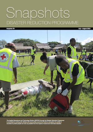
Snapshots 79, Disaster Reduction Programme, July - August, 2012
Friday, 14 September 2012 13:06
administrator
From the Manager’s Desk
We’ve passed the mid-point for 2012 and have developed a few stories from the work we’ve done over July and August which we hope you will find interesting. These recent months have also seen a hive of activity for us in terms of our preparations for the 4th session of the Pacific Platform for Disaster Risk Management and Regional Water & Sanitation Consultations which are coming together this year in Noumea, New Caledonia on 17th – 21st September. We hope to have some interesting results from that meeting and look forward to sharing these with you in our next edition.
In July, SOPAC DRP bade farewell to our Training Support Officer, Vuli Gauna. During his time with the programme he visited a number of Pacific Island countries to assist with the development of national trainers and to implement DRM training courses in support of national capacity building efforts. Vuli recently led the completion and implementation of the new Disaster Risk Reduction course – a major undertaking.
Vuli has taken up a position with the International Federation of Red Cross and Red Crescent Societies (IFRC) regional delegation in Suva, as the Regional Disaster Management Programme Manager, and can be contacted at
This e-mail address is being protected from spambots. You need JavaScript enabled to view it
.
We wish Vuli all the best in his future endeavours and know that his disaster management training expertise will still be utilized across the region in his new career.
I hope you will enjoy reading this edition.
Read Online | Download Full Issue (766Kb)
Mosese Sikivou
Deputy Director, Disaster Reduction Programme
Last Updated on Sunday, 16 September 2012 12:13
|
Deep Sea Minerals Training Workshop Important for Pacific
Friday, 14 September 2012 12:43
administrator
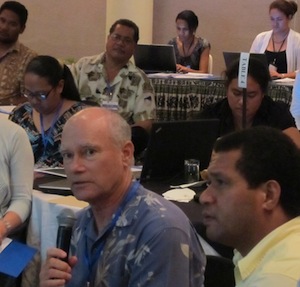
13th September 2012 - A deep-sea minerals training workshop to address issues associated with deep-sea minerals and mining, was recently held in Nadi as part of a series of capacity building activities aimed to develop and enhance regional knowledge on geological, technological, biological and environmental aspects of deep-sea minerals.
The workshop was organised by the EU-funded, SPC Deep Sea Minerals (DSM) Project. Participants included Government officials, primarily from Ministries of 13 island countries associated with minerals, natural resources, environment and fisheries, as well as representatives from regional civil society groups. These included the Pacific Islands Association of NGOs (PIANGO), Ipukarea Society (TIS) and the Civil Society Forum of Tonga (CSFT).
Scientists from the United States, Korea, Australia, Belgium, New Zealand, SPREP and SPC were also in attendance.
Dr Russell Howorth, the Director of the SOPAC Division of the Secretariat of the Pacific Community (SPC) said that the workshop played an important role in providing participants with a better understanding of deep-sea environments, the nature of those seabed mineral deposits and the biological communities associated with them.
‘The protection of the ocean environment and the preservation of rare and fragile ecosystems and ocean habitats must be balanced against the emerging new economic opportunity presented for Pacific Island countries by exploring for deep sea minerals and their possible future exploitation,’ said Dr Howorth. ‘The precautionary approach must prevail particularly in the exploration and potential exploitation of seabed mineral deposits.’
Last Updated on Friday, 14 September 2012 13:14
Read more...
Cook Islands prepares for climate change impacts
Tuesday, 04 September 2012 15:24
administrator
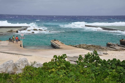
31st August 2012 - A study of tropical cyclones and associated wave action is providing information that can be used to assess the resilience of Mangaia, the most southern of the Cook Islands, to the impacts of climate change and sea level rise.
Mr Jens Kruger of the Secretariat of the Pacific Community (SPC) said that with coastal communities, private property, family homes and public infrastructure, such as the harbour, already exposed to extreme weather events, the recent study will help to support a risk-based approach to climate change adaptation.
Mr Kruger is the Physical Oceanographer with SPC’s Oceans and Islands Programme in the Applied Geoscience and Technology (SOPAC) Division.
He explained that data gathered during the study can be used to develop models of different scenarios to assess how changes in the climate and sea level would affect the frequency, magnitude and extent of coastal inundation on the island of Mangaia.
The data were collected by a team from SPC/SOPAC, the Cook Island's Ministry of Infrastructure and Planning, and New Zealand’s National Institute of Water and Atmospheric Research.
The research is part of the Pacific Adaptation to Climate Change project, funded by the Global Environment Facility through UNDP Samoa and SPREP (Secretariat of the Pacific Regional Environment Programme). The project involves 14 Pacific Island countries including Cook Islands.
‘A key outcome of the study has been the Cook Islands Coastal Calculator, an engineering spreadsheet that can be used to provide information on waves and water levels at the shoreline, wave run-up and the resulting inundation,’ said Mr Kruger.
Last Updated on Tuesday, 04 September 2012 15:41
Read more...
|


