Keynote Address - Dr Russell Howorth - 2012 Pacific GIS/RS Conference
Tuesday, 27 November 2012 16:02
administrator
Distinguished Guests, and Colleagues,
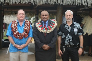
It is with much pleasure as Director of the SOPAC Division of the SPC that I present to you this morning the Keynote Address for this Conference, the largest of its kind in the region and which was set up to showcase new tools and concepts for improved data collection, capabilities and analysis in GIS and Remote Sensing. At the same time I would like to acknowledge Dr Jimmie Rodgers the Director General of the SPC who is unable to be here today and he gives his apologies.
Firstly, however it would be remiss of me if I did not take this opportunity to welcome all of you here this morning to the Opening of this Conference, and in particular I extend a welcome to all representatives of island governments and administrations, donor partner representatives, representatives of CROP organisations, educationalists, scientists and technologists from other stakeholder groups including NGOs. In particular I would like to highlight the many representatives from the private sector, including satellite data providers, image resellers, software and hardware companies. We have gathered here in the room a genuine mix of providers, developers and users.
Secondly, I would like to acknowledge that I have been privileged to address this conference over recent years and in that context I would like to acknowledge that having something different to say has never been difficult. GIS and Remote Sensing is one of the fastest developing technologies no matter whether you are a provider, and developer or a user.
On the global agenda the outcome of Rio+20 this year "The Future We Want" contains a particular paragraph of relevance:
274. We recognize the importance of space-technology-based data, in situ monitoring, and reliable geospatial information for sustainable development policy-making, programming and project operations.
And here in the region and for the benefit of Pacific island countries and territories we are all striving to stay at the "cutting edge of the technology." In this regard the theme of this Conference focusing on mapping Pacific resources is very timely.
Last Updated on Monday, 03 December 2012 10:25
Read more...
Conference to Explore GIS Mapping
Friday, 23 November 2012 12:13
administrator
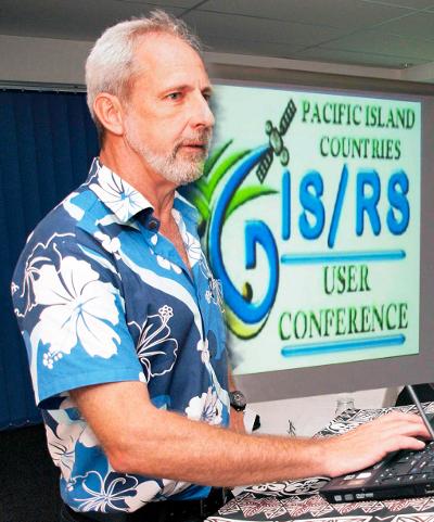
More than 150 delegates from around the world will meet in Suva next week (27) to participate in a GIS conference that will explore developments in this new science “that is already influencing the way we live our lives,” according to Wolf Forestrueter, SPC/SOPAC, Division Senior Officer GIS/RS Adviser
Held at the Holiday Inn, the 2012 Pacific Island Countries Geographic Information System (GIS) and Remote Sensing User (RS) Conference has chosen at its theme, “Mapping Pacific Resources” as an endorsement of the work undertaken in the region that profiles an array of applications including the management of resources of the small island Pacific nations.
GIS is a computer-based tool used to collect, combine and overlay information in the form of easily understood maps constructed from up-to-date satellite images and field data. Remote sensing is the collection of information about earth at a distance from aircraft or satellite.
“The GIS technology is already being used to map landslides, detect vegetation change, map town boundaries, map impacts of sea level rise. It has proven useful in the helping utilities and transportation better define their resources.
“The public might be more familiar with results closer to home where many smart phone applications and social media tools combine data with maps to deliver unique new services to consumers, Goggle Earth is an example,” said Mr. Forestrueter.
The four-day conference will feature GIS and remote sensing scientists and technicians to explore new developments and how they may apply to improving the lives of the people in region.
Last Updated on Tuesday, 27 November 2012 16:15
|
SOPAC 2 Meeting Outcome Statement Considered by CRGA 42
Friday, 23 November 2012 08:40
administrator
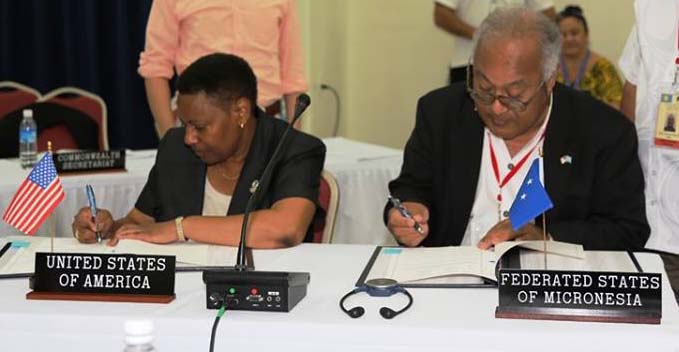
The second meeting of the Applied Geoscience and Technology Division (SOPAC) of the Secretariat of the Pacific Community (SPC) was held at the Jacques Iekawe conference hall at the SPC eadquarters in Noumea, New Caledonia, from 6 to 9 November 2012; and chaired by the representative of the Government of the Federated States of Micronesia. The meeting was preceded by the 9th Meeting of the Science, Technology and Resources Network (STAR).
The Chair's Outcome Statement from the SOPAC-2 meeting was considered by Committee of Representatives of Governments and Administrations (CRGA), a committee of SPC's governing body, which meets annually to discuss SPC’s work programme and governance issues. The 42nd meeting of CRGA was held at SPC headquarters in Noumea, New Caledonia on 12-16 November 2012.
Download the SOPAC-2 Chairs Outcome Statement that was considered by CRGA 42.
Last Updated on Tuesday, 23 April 2013 09:24
SOPAC Recognises World GIS Day
Friday, 16 November 2012 09:26
administrator
The World GIS Day, celebrated on 14th November every year, offers everyone a chance to learn more about the fascinating field of Geographic Information Systems and how GIS is part of our everyday lives today.
"Many young people are using GIS technology every day without even realising it. Many smart phone applications and social media tools combine data with maps to deliver unique services to consumers and Google Earth is known by most of us" advised Dr Wulf Killmann Team Leader of the SPC/GIZ project “Coping with Climate Change in the Pacific Island Region” and Dr Russell Howorth, Director of the Applied Geoscience and Technology Division of the Secretariat of the Pacific Community in a joint statement released to recognise World GIS Day.
GIS (Geographic Information Systems) are a set of computer-based tools used to collect, combine and overlay information in the form of easily understood maps constructed from up-to-date satellite images and field data, while remote sensing is the collection of information about the earth from a distance.
In the Pacific, GIS is now being used as a tool to map landslides, detect vegetation change, map town boundaries, map impacts of sea level rise and many more. GIS is quite useful in the area of utility, transportation, and might become a tool to model climate change.
Applied Geoscience and Technology Division (SOPAC) of Secretariat of the Pacific Community is the leading agency for GIS in the Pacific and hold images and GIS Data for its member countries and territories. SOPAC's primary goal is to apply geoscientific data and technology to realise new opportunities for improving the livelihoods of Pacific communities. SOPAC's work in GIS and remote sensing is supported by many partners including the German Government through the SPC/GIZ, Coping with Climate Change in the Pacific Island region.
While GIS practitioners around the world celebrates this day by holding workshops, seminars. The SOPAC division of SPC, supported by many partners, is working tirelessly to organise a conference held each year for all Pacific island countries and territories.
Last Updated on Sunday, 18 November 2012 15:43
Read more...
|


