Understanding Risk To Enhance Community Safety
Thursday, 17 October 2013 15:51
administrator
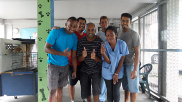
Monday, 14 October, Secretariat of the Pacific Community (SPC) - From 14th to 17th October, a team from the Secretariat of the Pacific Community’s (SPC) Applied Geoscience and Technology Division (SOPAC) will be visiting French Polynesia. They will report on the results of a series of studies designed to reduce the risk of storm surge in the Tuamotu Islands, a strategic area for pearl culture, tourism and environmental conservation.
This project was implemented over a two-year period and is now entering its final phase. Its objective was to define with more accuracy the impact of storm surge in coastal areas in order to enhance community safety.
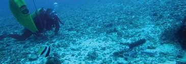
Based on proven scientific techniques, four studies were conducted to determine the risk of flooding during an extreme tropical cyclone. Flood hazard was assessed using bathymetric, oceanographic and topographic data collected in strategic areas of the Tuamotu Islands. These data were used to produce a bathymetric chart of Rangiroa, the largest atoll in French Polynesia, detailing the depth of the lagoon and channels. SPC experts also produced inundation maps by modelling storm surge in a number of key areas.
Last Updated on Wednesday, 23 October 2013 08:51
Read more...
Stakeholders in Cook Islands discuss roadmap for disaster and climate resilient development
Tuesday, 15 October 2013 15:34
administrator
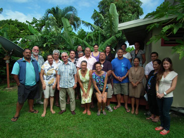
Tuesday 15 October 2013, Secretariat of the Pacific Community (SPC), Rarotonga, Cook Islands - The Office of the Prime Minister in Cook Islands called a special meeting of the National Platform for Climate Change and Disaster Risk Management on Friday 4 October, 2013. The purpose of the meeting was to facilitate stakeholder input in Cook Islands for the proposed new regional strategy for disaster and climate resilient development in the Pacific (SRDP).
The development of the SRDP, referred to as 'the roadmap process’, is led by Pacific Island countries and territories. Stakeholder engagement is being sought throughout the Pacific region in a variety of forums. During the Cook Islands meeting participants had the opportunity to learn about the roadmap process and provide their suggestions concerning its development.
Teina Mackenzie is an Executive Board Member for the Te Ipukarea Society, an environmental NGO in Cook Islands. She says, ‘The most encouraging aspect of the recent meeting is that it seeks true engagement of stakeholders and the community at the outset of the proposed strategy.’
Last Updated on Tuesday, 15 October 2013 15:40
Read more...
|
Prospect: News from Deep Sea Minerals Project - Issue 2, September 2013
Thursday, 03 October 2013 14:26
administrator

The second issue of The Prospect is pleased to bring you news and developments from the SPC-EU Pacific Deep Sea Minerals Project and its participating member countries. The Deep Sea Minerals Project is designed to help Pacific Island governments ensure that any efforts to harvest deep sea minerals will directly support national economic development while also minimizing any negative impacts on the environment and local communities.
The Project is funded by the European Union and managed by SOPAC, the Applied Geoscience & Technology Division of the Secretariat of the Pacific Community, on behalf of 15 Pacific Island Countries: the Cook Islands, Federated States of Micronesia, Fiji, Kiribati, Marshall Islands, Nauru, Niue, Palau, Papua New Guinea, Samoa, Solomon Islands, Timor Leste, Tonga, Tuvalu and Vanuatu
View Online | Download
Last Updated on Thursday, 03 October 2013 14:31
Experts Praise Pacific Sea Level Monitoring Project
Monday, 30 September 2013 10:06
administrator
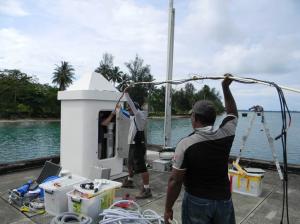
Tuesday, 24 September 2013, Secretariat of the Pacific Community (SPC), Suva, Fiji – Regional experts in land and marine survey and management commended the work of the AusAID-funded Pacific Sea Level Monitoring (PSLM) Project at the International Federation of Surveyors (FIG) Symposium in Suva last week.
Among them was Professor John Hannah of the University of Otago, who chairs the FIG Climate Change Task Force. Addressing the conference, Professor Hannah said, ‘Monitoring is crucial. We need reference systems and data sets that allow us to monitor change accurately.’
‘I congratulate our colleagues in the Pacific Sea Level Monitoring Project ─ thanks to that initiative, many small islands have a reliable continuous data set. We need to see more of this in the region.’
The project has been collecting data from 14 sites across the Pacific since 1991. Over-water monitoring stations in Fiji, Tonga, Samoa, Vanuatu, Papua New Guinea, Marshall Islands, Pohnpei, Kiribati, Cook Islands, Palau, Tuvalu, and Nauru provide a continuous stream of high-quality data on sea level, tides, water and air temperature, barometric pressure, and windspeed and direction. In addition, land-based global navigation satellite system (GNSS) stations in each country measure seismic movements and provide geodetic benchmarks for the sea-level stations.
All of this data is necessary for scientists to calculate sea-level change relative to land elevation. The data has many other uses, however. It is publically accessible and is frequently referenced for coastal development projects, urban planning, tidal predictions, formulation of maritime boundaries, wave modelling and for navigational purposes.
Last Updated on Monday, 30 September 2013 11:11
Read more...
|