


Monday, 14 October, Secretariat of the Pacific Community (SPC) - From 14th to 17th October, a team from the Secretariat of the Pacific Community’s (SPC) Applied Geoscience and Technology Division (SOPAC) will be visiting French Polynesia. They will report on the results of a series of studies designed to reduce the risk of storm surge in the Tuamotu Islands, a strategic area for pearl culture, tourism and environmental conservation.
This project was implemented over a two-year period and is now entering its final phase. Its objective was to define with more accuracy the impact of storm surge in coastal areas in order to enhance community safety.
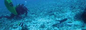
Based on proven scientific techniques, four studies were conducted to determine the risk of flooding during an extreme tropical cyclone. Flood hazard was assessed using bathymetric, oceanographic and topographic data collected in strategic areas of the Tuamotu Islands. These data were used to produce a bathymetric chart of Rangiroa, the largest atoll in French Polynesia, detailing the depth of the lagoon and channels. SPC experts also produced inundation maps by modelling storm surge in a number of key areas.
To complement the scientific studies, an economic analysis was carried out to propose cost-effective adaptation solutions to the French Polynesia Government in order to enhance community safety.
This European Union-funded project has made it possible to put forward a series of recommendations for the French Polynesia Government to consider as part of its efforts to protect communities and infrastructure from the risk of natural disasters.
For more information, please contact Frédérique Lehoux at This e-mail address is being protected from spambots. You need JavaScript enabled to view it

