 Another month and unfortunately another major devastating event. We must all take a moment to remember those whose lives have been changed forever by the earthquake and tsunami that ravaged northeaster Japan earlier this month. The tragedy is quite immense and each day we hear and see stories that remind us of why we work in this area of disaster risk management.
In the region there have been a number of interesting developments as this issue of Snapshots will portray. In Papua New Guinea we’re into the home stretch in relation to a DRM Action Plan for Morobe Province. The work on this started last year and Waisale Naqiolevu, our man on the ground has an interesting piece on this.
Home  News & Media Releases Latest
Latest
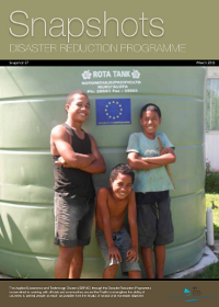
Snapshot 67 - Disaster Reduction Programme - March 2011


|
||
|
||
|
|
||
| Page 55 of 74 |
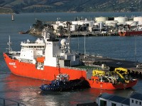 12 APRIL 2011 NUKU’ALOFA (GOVERNMENT OF TONGA) - A Korean research vessel will carry out scientific studies on seabed minerals in Tongan waters over the next several months.
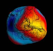 A fairly important development for Pacific islands mapping initiatives has occurred because of the results of the recently concluded European Space Agency GOCE (Gravity field and steady-state Ocean Circulation Explorer) mission.
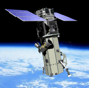 Pacific Island countries and territories are challenged by the necessity to update their maps to reflect the current day realities. “Countries are utilising several mapping systems, or projections, in parallel,” explained Dr Wolf Forstreuter, SOPAC’s Remote Sensing and Geographic Information Systems (GIS) Specialist. SOPAC is the Applied Geoscience and Technology Division of the Secretariat of the Pacific Community (SPC).
Newsflash
Concerns about protecting the environment during exploration and mining for deep seabed minerals will not be addressed by a ‘one size fits all’ solution. Dr Clark said that the more we learn about the deep sea the more we realise that parts of it are split up into smaller environmental packages, and we don’t have a good understanding of how large these package-like “ecosystems” are, or the degree of connectivity between them. There are three types of deep seabed deposits that are being considered as potential resources to be mined: massive sulfide deposits cobalt crusts, and manganese nodules. |


