Fiji Explores Deep Sea Minerals and Mining at Workshop
Tuesday, 03 April 2012 09:17
administrator
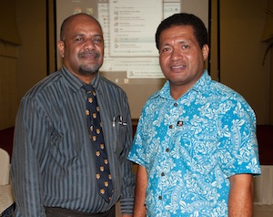
The Director of Fiji’s Mineral Resources Department, Mr. Malakai Finau told participants in a one day Fiji National Deep Sea Mineral Consultation Workshop held in Suva recently that “with deep sea mineral exploration being granted within the Fiji waters it is important to proceed with caution, to strike a balance between economic development and the protection of the environment.”
The workshop is part of in-country stakeholder consultation process organized by SOPAC Division of the Secretariat of the Pacific Community (SPC) through the European Union funded Deep Sea Mineral Project in fifteen Pacific ACP States. This consultation allows government officials as well as representatives of the private sector, academic institutions and civil society groups to explore issues relating to deep seabed minerals and mining.
Similar meetings have already been held in Kiribati, Nauru, Tonga, Samoa and now Fiji. According to SPC-EU Deep Sea Mineral Project Team Leader, Akuila Tawake, there will be a further ten countries where the consultation workshops will be held in the next five months.
Last Updated on Tuesday, 03 April 2012 09:24
Read more...
Solomons Benefits From Mapping Technologies
Wednesday, 21 March 2012 10:02
administrator
 “What is an absolute necessity is these Geographic Information System (GIS) and Remote Sensing (RS) tools are developed in an integrated and strategic manner for all those involved in these technologies.” “What is an absolute necessity is these Geographic Information System (GIS) and Remote Sensing (RS) tools are developed in an integrated and strategic manner for all those involved in these technologies.”
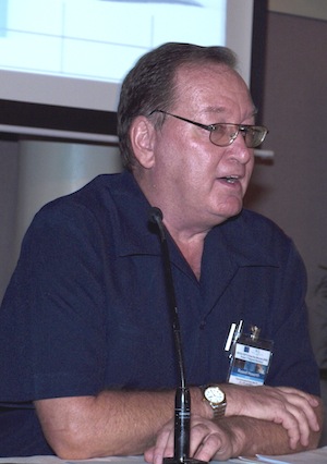
Dr. Howorth, the Director of the SOPAC Division of the SPC, was addressing the first Solomon Islands National Geographic Information System (GIS) and Remote Sensing Stakeholder Meeting as its keynote speaker.
He said that the goal of the SOPAC Division is to apply geoscience and technology to realize new opportunities for improving the livelihoods of Pacific communities. GIS and Remote Sensing is clearly a technology that can contribute to realizing improving livelihoods.
GIS is a computer-based tool used to collect, combine and overlay information in the form of easily understood maps constructed from up-to-date satellite images and field data, while Remote Sensing is the collection of information about the earth from a number of sources that could utilize satellites, aircraft, or electromagnetic radiation.
Dr. Howorth told the participants that Pacific islands share much in common and the Solomon Islands is no exception.
Last Updated on Monday, 26 March 2012 14:52
Read more...
Snapshot 74 January – February 2012
Friday, 16 March 2012 11:34
administrator
 This is our first edition for 2012. Although we'd have liked to get to all of our readers earlier in the year our Snapshots Editor was on a much deserved break. Well, Stephanie's back and raring to go! Her first task: to sort through a number of 'candidates' for this edition. There's been quite a lot happening. This is our first edition for 2012. Although we'd have liked to get to all of our readers earlier in the year our Snapshots Editor was on a much deserved break. Well, Stephanie's back and raring to go! Her first task: to sort through a number of 'candidates' for this edition. There's been quite a lot happening.
One of our major commitments for 2012 is to work closely with SPREP and the UNISDR to lead the process of developing an integrated regional strategy for DRM and Climate Change by 2015. We've had a series of meetings with these partner organisations this year and we're almost ready to move forward and recruit an individual to lead the preparatory work. In addition, we have the biennial progress reviews of the Hyogo Framework for Action and Pacific DRR and DM Framework for Action which will undertaken at regional level and as well at national level in all 14 Pacific island countries between May and September.
As it has been every year since 2009 the Pacific Platform for DRM signifies a major commitment in the DRP calendar for 2012. This year's meeting will be held in Noumea, New Caledonia from 17th - 21st September. As we progress over the coming months we'll provide you accounts of our preparations.
I hope you enjoy reading this edition of Snapshots and as always if you have any queries or helpful suggestions just drop us a line.
Mosese Sikivou
Deputy Director, Disaster Reduction Programme
Download Full Edition | Read Online
Last Updated on Friday, 16 March 2012 13:51
Enhanced Image Pre-Processing at SOPAC for the Pacific
Friday, 09 March 2012 14:56
administrator
 Pacific Island Countries are generally surrounded by large areas of ocean over which clouds easily build up within the lower atmosphere with increasing altitude. The micro-climate of the moisture-laden lower atmosphere is very inhomogeneous and can distort images captured by optical satellites. An atmospheric correction is therefore important in order to enhance image data. Beginning in 2011, atmospheric correction software has started to incorporate the digital elevation model to reduce relief related atmospheric disturbances. Pacific Island Countries are generally surrounded by large areas of ocean over which clouds easily build up within the lower atmosphere with increasing altitude. The micro-climate of the moisture-laden lower atmosphere is very inhomogeneous and can distort images captured by optical satellites. An atmospheric correction is therefore important in order to enhance image data. Beginning in 2011, atmospheric correction software has started to incorporate the digital elevation model to reduce relief related atmospheric disturbances.
The Applied Geoscience and Technology Division of SPC is the hub of satellite image data purchase within the region, and the Division also enhances the image data for Pacific users including the application of an atmospheric correction. SOPAC therefore maintains a working relationship with global software developers adjusting software specifically for Pacific conditions.
Last Updated on Friday, 09 March 2012 15:01
Read more...
|
Pacific GIS Units empowered with Free and Open Source Software
Monday, 26 March 2012 14:39
administrator

Tuesday, 20th March, Suva - Using the right tool for the right job is a common mantra amongst data specialists, but in the Pacific, access to, and more importantly, knowledge about relevant software tools is not readily available.
In the Geographic Information Systems (GIS) domain, undertaking even basic tasks entails using expensive proprietary software solutions. These software solutions are beyond the budget of many government and academic GIS units in the region, and this has resulted in rampant piracy and illegal use of such software.
Seeing a need for freely available GIS software, which has no licensing restrictions, SOPAC Division of SPC actively advocates the use of, and subsequently, provides relevant training on Free and Open Source (FOSS) Geo-spatial software through the work of its SOPAC Division.
In a recent training trip to Solomon Islands Power Authority, Mr Edwin Liava'a, Utilities GIS Specialist, SOPAC Division, deployed FOSS GIS software on their network and conducted relevant training. The software package he used was specifically built for Pacific Islands GIS Units by SOPAC Division.
Last Updated on Monday, 26 March 2012 14:51
Read more...
Lifuka Island, Tonga, at the forefront in understanding climate change impacts on small islands
Monday, 19 March 2012 06:43
administrator
 Nukualofa, Friday 16 March 2012: How exactly will climate change impact the lives of people living on small islands and what can be done to adapt to those impacts? On Lifuka Island in Tonga’s Ha’apai group, a project to find answers to this question is underway. The answer could help people around the Pacific and the world prepare for, and adapt to, climate change. Nukualofa, Friday 16 March 2012: How exactly will climate change impact the lives of people living on small islands and what can be done to adapt to those impacts? On Lifuka Island in Tonga’s Ha’apai group, a project to find answers to this question is underway. The answer could help people around the Pacific and the world prepare for, and adapt to, climate change.
The project is part of the Pacific Adaptation Strategy Assistance Program (PASAP) and aims to assess the vulnerability and adaptation to sea level rise in Lifuka. It is being run by the Government of Tonga with the assistance of the Secretariat of the Pacific Community (SPC) and the Tonga Community Development Trust (TCDT).
Fuka Kitekei’aho, National Coordinator for PASAP, said that Lifuka was chosen because it had already experienced sea level rise as a result of an earthquake in May 2006.
“The earthquake measured approximately 7.9 on the Richter scale and resulted in subsidence of 23 cm of the western side of Lifuka Island,” Mr Kitekei’aho said. “In the past four years, the island has experienced significant coastal erosion over a three kilometre section of the coastline, including where the harbour, homes, and hospital are located.”
Last Updated on Tuesday, 20 March 2012 08:06
Read more...
Federated States of Micronesia Briefing
Monday, 12 March 2012 07:55
administrator
 Federated States of Micronesia Ambassador to Fiji, H.E. Gerson Alik Jackson was briefed at the Suva headquarters of the Applied Geoscience and Technology Division (SOPAC) of the Secretariat of the Pacific community (SPC) on Friday 9th March. Federated States of Micronesia Ambassador to Fiji, H.E. Gerson Alik Jackson was briefed at the Suva headquarters of the Applied Geoscience and Technology Division (SOPAC) of the Secretariat of the Pacific community (SPC) on Friday 9th March.
This visit was a follow-up to a meeting with the SOPAC Director, Dr Russell Howorth and the Manager of the SPC North Pacific Regional Office, Mr Amena Yauvoli. The senior technical advisers at the SPC/SOPAC Division office who are working with the FSM briefed the Ambassador on five important areas of SPC/SOPAC Division work currently underway for the FSM.
Last Updated on Monday, 12 March 2012 15:14
Read more...
New film highlights water issues and solutions in Tuvalu
Friday, 09 March 2012 08:12
administrator
 Funafuti, Tuvalu, March 5, 2012: A new film released today looks at the serious water issues facing Tuvalu and how the Global Environment Facility supported Pacific Integrated Water Resources Management project (GEF Pacific IWRM) is working to address these problems by installing composting toilets on the main island of Funafuti. Funafuti, Tuvalu, March 5, 2012: A new film released today looks at the serious water issues facing Tuvalu and how the Global Environment Facility supported Pacific Integrated Water Resources Management project (GEF Pacific IWRM) is working to address these problems by installing composting toilets on the main island of Funafuti.
The film ‘Falevatie: A toilet for our future’ shows how composting toilets can help conserve water and minimise threats to the environment, food security and human health.
Tuvalu recently experienced a devastating drought, which resulted in a national emergency and millions of dollars spent on an international relief effort to get water to the small isolated country.
Last Updated on Friday, 09 March 2012 15:01
Read more...
|