Latest mapping technology used in fight against flooding
Wednesday, 30 May 2012 16:21
administrator

The very latest mapping technology is being used in the Nadi and Ba basins to produce extremely detailed digital terrain models as part of an ongoing effort to lessen the effects of floods in the area.
For the last two weeks an Island Hoppers helicopter fitted with Light Detection and Ranging (LIDAR) equipment has flown over the Nadi area scanning the ground with near infrared light to get the most detailed topographical data of the area ever recorded.
According to Litea Biukoto, from the Disaster Reduction Programme at the Secretariat of the Pacific Community’s Applied Geoscience and Technology Division (SPC SOPAC), having high resolution topographical information is essential for producing detailed floodplain maps that can help the National Disaster Management Office, the Nadi Town Council, and other government agencies to plan development in the floodplain, provide guidance for infrastructure and building designs and improve flood preparedness and response.
Last Updated on Monday, 04 June 2012 10:04
Read more...
Pacific Islands Face Severe Water Threats, New Report says
Thursday, 17 May 2012 13:28
administrator
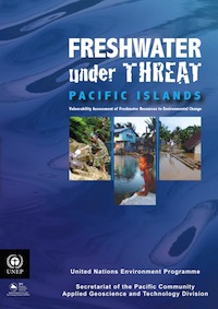 The unique freshwater challenges facing many small islands in the Pacific are highlighted in a new report released today by the UN Environment Programme and the Secretariat of the Pacific Community (SPC). The unique freshwater challenges facing many small islands in the Pacific are highlighted in a new report released today by the UN Environment Programme and the Secretariat of the Pacific Community (SPC).
The report, “Freshwater under Threat – Pacific Islands”, written by David Duncan, Regional Environmental Engineer at SPC SOPAC’s Water and Sanitation Programme, found that the almost total reliance on rain-fed agriculture across all islands puts economies and livelihoods at risk. Nearly 10% of deaths of children under five in the region are attributable to water related causes; 90% of these deaths, according to the report, can be traced to poor sanitation treatment systems.
The delivery of water supplies and sanitation services in many Pacific countries currently falls well short of Millennium Development Goal (MDG) targets. According to the report, access to improved drinking water sources in Fiji and Papua New Guinea (at 40% and 47%, respectively) is about half the global average and it is anticipated that both countries will fall significantly short of the Millennium Development Goal (MDG) for improved drinking water access.
Last Updated on Thursday, 17 May 2012 13:32
Read more...
Solomon Island Nurses Train in Disaster Risk Management
Monday, 14 May 2012 14:46
administrator
 As a part of their final year curriculum, 71 trainee nurses at the Solomon Islands College of Higher Education (SICHE), have received training in disaster management and damage assessment. As a part of their final year curriculum, 71 trainee nurses at the Solomon Islands College of Higher Education (SICHE), have received training in disaster management and damage assessment.
Mr Vuli Gauna assisted the facilitation of the Introduction to Disaster Management (IDM) and Initial Damage Assessment (IDA) courses that were held at SICHE in April.
He is the Training Support Officer working with The Asia Foundation and USAID / Office of the US Foreign Disaster Assistance, Pacific Disaster Risk Management Program (PDRMP), based at the SPC/SOPAC campus in Fiji.
“The disaster management training assists the nurses to look at identifying opportunities within community development programmes where prevention, mitigation and preparedness measures can be applied to help in reducing disaster risks."
The damage assessment training provides knowledge and tools on how best to collect and record information for reporting of damage resulting from hazard impacts, which is important for government’s response efforts during any disaster,” said Mr Gauna.
Upon graduation, many of these nurses will take up positions at health centres and nursing stations in the more remote villages and communities, spread throughout the 300 inhabited islands within the Solomon Islands group.
Last Updated on Thursday, 31 May 2012 18:55
Read more...
President Toribiong endorses Palau’s first National Water Policy
Tuesday, 24 April 2012 13:32
administrator

Koror, Palau, Monday April 23rd 2011: Palau’s President, Johnson Toribiong, endorsed his country’s first National Water Policy this week saying that it “will serve as a clear indicator and important guide for our nation's future economic and sustainable development based on clean and safe water that is essential for the health of our people, ecosystem and economy.”
The policy aims to protect and conserve Palau’s water resources, ensure Palauans have access to safe, affordable, sustainable water supply and wastewater services, and see that these services are managed and operated sustainably and effectively.
The National Water Policy was developed by Palau’s Ministry of Natural Resources, Environment and Tourism in partnership with a European Union funded Integrated Water Resources Management (EU IWRM) Planning Project being run by the Secretariat of the Pacific Communities’ Water and Sanitation Programme (SPC WSP).
Gwen Sisior, the Ministry’s Water Policy Officer, said one of the key goals of the policy was to ensure that responsibility for key aspects of water and wastewater management was spread across different organizations in a coordinated and integrated manner.
“What we don’t want to see happen is a fragmented sectoral approach to managing our water supply. Organizations should work together to clarify the specific roles, responsibilities, activities and timelines to implement and support the national water policy,” Ms Sisior said. “Water development and management should be based on a participatory approach and value collaborations from users, planners and policy-makers. Decision-makers should strive to ensure effective communication with all stakeholders, multiple sectors and different levels of various organizations.”
Last Updated on Tuesday, 24 April 2012 13:46
Read more...
|
SOPAC Division Quarterly Newsletter, Jan - Mar 2012
Monday, 04 June 2012 09:56
administrator

Inside This Issue
- Palau Deeply Appreciates Completion of Eu-Funded National Emergency Operations Centre
- Ocean and Islands Programme Completes Critical Survey in the State of Yap, Fsm
- Pacific Gis Units Empowered With Free and Open Source Software
- Eu-Funded C-Envelope Project Aid in the Tuamotu Survey
- Australian-Funded Sea Level Monitoring Projects Aids Maritime Boundary Delineation
- Different Responses Required for Different Seabed Minerals Operations
- Spc Sopac Takes World Water Day 2012 to the West Fiji
- Mapping Fiji’s Forest Cover With the Help of Satellite Imagery
- Pacific Sea Level & Climate Monitoring Project (SPSLCMP) Data Help Pacific Island Countries Develop Their Maritime Boundaries
- Federated States of Micronesia Briefing
Download (1.3Mb)
Last Updated on Tuesday, 19 June 2012 09:25
Pacific Sea Level & Climate Monitoring Project
Thursday, 17 May 2012 12:50
administrator
 The data and facilities provided by the South Pacific Sea Level and Climate Monitoring Project (SPSLCMP) is well known for its use in tracking sealevel change and variability over time and is even used to track sealevel changes which occur due to storms and tsunami in the Pacific Islands Region. The data and facilities provided by the South Pacific Sea Level and Climate Monitoring Project (SPSLCMP) is well known for its use in tracking sealevel change and variability over time and is even used to track sealevel changes which occur due to storms and tsunami in the Pacific Islands Region.
However, it is not generally known that SPSLCMP data and facilities also provide a critical service and information which supports work by the Ocean & Islands Programme’s Maritime Boundary Sector.
Given these two work Sectors both lay within the Ocean & Islands Programme, it’s easy to overlook the close and complementary interaction but it’s a story worth telling. Maritime Boundaries (often just thought of as EEZs – Exclusive Economic Zones) have to be very accurately measured from the shores of each Island State or Territory.
That shoreline starting point is called a “baseline” and in the Tropical Pacific these usually correspond to a line “drawn” using GIS techniques around the outer reef edges of an island or island group at Lowest Astronomical Tide (LAT).
Last Updated on Thursday, 31 May 2012 18:56
Read more...
Snapshots 76, Disaster Reduction Programme, April 2012
Friday, 11 May 2012 10:09
administrator

Dear Readers,
Welcome to the April edition of Snapshots. As is usually the there are a number of interesting developments in DRM capacity building across the region that we have been fortunate to be able to contribute to and I hope you enjoy reading about them in this addition.
In addition, we are pleased to advise that good progress is being made on securing €20 million for Pacific ACP States in relation to the EU EDF10 ACP-EU Natural Disaster Facility. We’re working hard to complete the necessary documentation for the NDF this year so that the funds can flow through to the region to facilitate implementation of country priorities in early 2013.
These funds will provide complementary support to a range of funding mechanisms which the region benefits from already through both the ‘disaster’ lens and as well through Climate Change Adaptation support.
I hope you enjoy this edition.
Last Updated on Friday, 11 May 2012 10:19
Snapshots 75, Disaster Reduction Programme, March 2012
Thursday, 12 April 2012 14:10
administrator

From the Managers Desk
Bula Readers,
I am writing this (1st April) while stranded in Sydney since all flights into Fiji have been cancelled due to the floods that are wreaking havoc in many parts of Viti Levu. The reports that have come through are painting a bleak picture but SOPAC/SPC and other partner organisations like UNOCHA are already moving to provide assistance to the Fiji Government.
Over the coming days we will get a better appreciation of what the needs are and be able to collaborate better to provide focussed support. In the coming months we will be able to relate to you our activities that supported Fiji’s response and recovery from the flood disaster.
DRM capacity building moves forward and there have been some interesting activities that we have been able to support over the last month or so. I hope you enjoy reading about them.
Please contact us if you have any suggestions to help us improve how we present updates to you or if you have stories of your own that you wish to share.
Mosese Sikivou
Deputy Director, Disaster Reduction Programme
Read Online | Download Full Issue
Last Updated on Thursday, 12 April 2012 15:02
|