 Former Director of Fiji Meteorological Services, Mr. Rajendra Prasad has been appointed the National Programme Officer for UNESCO/IOC. Mr. Prasad will be based in Suva working within the SOPAC’s Disaster Reduction Programme.
His primary responsibilities are to initiate and oversee activities related to the development and implementation of the Pacific Tsunami Warning system both at regional and national levels for two years.
Mr. Prasad will be involved in Disaster Risk Reduction activities for both UNESCO/IOC and SOPAC.
Home  News & Media Releases
News
Weatherman Rajendra Prasad Joins UNESCO


|
||
|
||
|
|
||
| Page 61 of 74 |
 Satellite technology has been used in helping to define voting districts put in place for the first time for the recent election held in the Kingdom of Tonga. The election was held on Thursday, November 25.
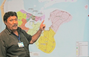
 Six Pacific island countries are in the process of reviewing the progress made in relation to their disaster risk management action plans and strategies.
 Close to 200 participants were told by SOPAC’s Director, Dr. Russell Howorth, that the development of Geographic Information Systems (GIS) and Remote Sensing will continue to be a major part of the SOPAC technical support service work programme.
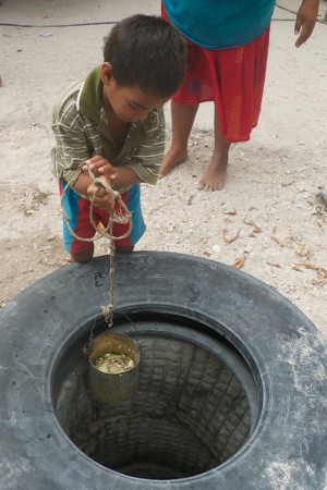 A recent outbreak of typhoid in Kiribati highlights how water borne diseases continue to be a major threat in the Pacific islands, especially in low-lying atolls. The capital island of Kiribati, Tarawa, has also received almost no rainfall over the last three months, putting additional stress on limited water supplies.
 Newsflash
The safety of navigation and the protection of the marine environment in the region took a positive step forward recently with the signing of a Memorandum of Understanding between the International Hydrographic Organization (IHO) and Secretariat of the Pacific Community (SPC). Hydrography is the study, surveying, and mapping of the oceans, seas and rivers, especially related to navigation and the environment. IHO is comprised of 80 member governments represented by their respective national hydrographic offices. Its objectives include the standardization of nautical charts as well as the adoption of reliable and efficient methods to conduct hydrographic surveys. |


