GSD News 2nd Quarter: April - June 2014
Tuesday, 22 July 2014 11:15
administrator
Last Updated on Thursday, 19 March 2015 13:21
Pacific Resource and Environmental Economics Network - Issue 10 June 2014
Wednesday, 16 July 2014 10:47
administrator

Welcome to the June 2014 edition of the PREEN Newsletter. This edition includes details of current projects in the field including an economic valuation of the Vatu-i-Ra Seascape of Fiji, and results from the first pilot study in the Alternative Indicators for Melanesia Initiative.
You will find information on the recently released ADB report on the economic costs of the water and sanitation situation in Tarawa, Kiribati, as well as recent training events on economics for sustainable resource use and conservation.
We welcome new articles as they emerge so please do share your new findings, projects and events with us to keep the network informed of developments in the Pacific.
Best wishes,
Anna Rios Wilks
PREEN coordinator
Download
Last Updated on Wednesday, 16 July 2014 10:51
SPC receives two awards for satellite imaging
Friday, 11 July 2014 14:22
administrator
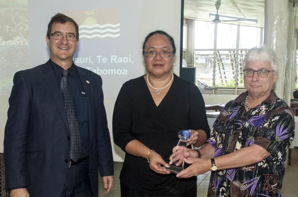
Friday 11 July 2014, Secretariat of the Pacific Community (SPC) headquarters, Noumea, New Caledonia – The Secretariat of the Pacific Community (SPC) geographic information systems (GIS) and remote sensing team has received two awards from the world’s leading supplier of satellite imagery, DigitalGlobe Inc., based in Colorado, USA.
They received a Partner Excellence Award 2014 for increased sales volume and meeting business growth expectations. SPC is the only authorised reseller of DigitalGlobe products in the Pacific Island region.
SPC members currently receive the highest-resolution satellite image data commercially available at some of the lowest prices on the planet.
Speaking at the awards ceremony held at SPC’s Suva Regional Office on Thursday 10 July, 2014 Wolf Forstreuter, GIS and Remote Sensing Specialist, explained emerging fields in the application of satellite imagery data.
‘Emily Artack, our Maritime Boundaries Technical Officer, used satellite image data for determination of maritime boundaries between Kiribati and Marshall Islands. This is a new application for satellite image data. And it is the first time that the International Seabed Authority has recognised satellite imagery as a legal tool to determine boundaries.’
Last Updated on Monday, 14 July 2014 15:19
Read more...
What is the Pacific Platform for Disaster Risk Management?
Tuesday, 10 June 2014 09:24
administrator
The 6th Session of the Pacific Platform for Disaster Risk Management, was recently co-convened by the Secretariat of Pacific Community (SPC) and the United Nations Office for Disaster Risk Reduction (UNISDR) from 2nd - 4th June at the Novotel Hotel in Suva, Fiji.
This important meeting was seeking to gain support for the draft Strategy for Climate and Disaster Resilient Development in the Pacific (SRDP) and the development of the Post- 2015 Framework on Disaster Risk Reduction which is to be endorsed at the 3rd World Conference on Disaster Reduction (3WCDRR) in Sendai, Japan in March 2015. Watch here for a 2-minute summary of key stakeholder views on the success of the Platform.
Last Updated on Wednesday, 25 June 2014 15:44
Read more...
|
Building Capacity for Resilient Development
Wednesday, 16 July 2014 09:02
administrator
Pacific Island countries are amongst the most disaster prone in the region, exposed to natural hazards such as floods, droughts, tropical cyclones, earthquakes, volcanic eruptions and tsunamis, which all pose a significant challenge to development in the Pacific region. A single disaster event can result in losses in the millions of dollars and can undo progress in areas such as infrastructure, agriculture, healthcare and education.
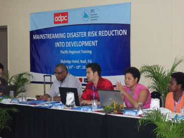
Despite recognition of the importance of disaster resilient approaches to development, many countries face challenges in identifying ways to effectively mainstream risk reduction considerations into national development planning processes. To address this, the Secretariat of the Pacific Community, in partnership with the Asian Disaster Preparedness Centre is holding a one week training workshop which focusses on how to mainstream Disaster Risk Reduction into development.
The training, in Nadi from 14-18th July, includes participants from the Cook Islands, Fiji, Samoa, Solomon Islands, Tonga and Vanuatu with representatives of National Disaster Management Offices and ministries responsible for national planning and finance. Representatives from the Pacific islands Forum Secretariat, Secretariat of the Pacific Community, Secretariat of the Pacific Regional Environment Programme and United Nations Development Programme will also participate in the training workshop.
Last Updated on Wednesday, 16 July 2014 09:05
Read more...
Snapshot 85 - Disaster Reduction Programme Newsletter, October 2013 - June 2014
Monday, 14 July 2014 10:26
administrator
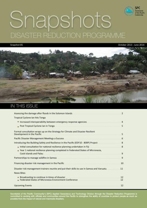
Secretariat of the Pacific Community's (SPC) Applied Geoscience and Technology Division through the Disaster Reduction Programme is committed to working with officials and communities around the Pacific to strengthen the ability of countries to protect people as much as possible from the impact of natural and manmade disasters.
Read Online | Download
IN THIS ISSUE:
1. Assessing the damage after floods in the Solomon Islands
2. Tropical Cyclone Ian hits Tonga
- Increased interoperability between emergency response agencies
- Post Tropical Cyclone Ian in Tonga
3. Formal consultation wraps up on the Strategy for Climate and Disaster Resilient Development in the Pacific
4. Pacific Disaster Management Meetings a Success
Last Updated on Wednesday, 16 July 2014 09:05
Read more...
CROP Agencies and International Stakeholders Highlight the Significance of Spatial Data for the Pacific
Wednesday, 25 June 2014 15:43
administrator

Tuesday, 24 June 2014, Secretariat of the Pacific Community (SPC), Suva - A broad range of geospatial data experts, managers and stakeholders from the Council of Regional Organisations in the Pacific (CROP), as well as partner agencies convened for the 2nd CROP Spatial Data Infrastructure meeting. The session was held at the Secretariat of the Pacific Community (SPC) in Suva on June 17th to 18th 2014.
The meeting was opened by Prof Michael Petterson, Director of SPC’s Applied Geoscience and Technology Division (AGTD), where he highlighted the various challenges facing effective geospatial data management in the Pacific. Such challenges cited were under-skilled staff, limited understanding by responsible personnel of available datasets, and obsolete formats of residing data. He encouraged the meeting to bring about some positive outcomes to address these and the many other challenges.
Last Updated on Thursday, 10 December 2015 09:54
Read more...
6th Session of the Pacific Platform for Disaster Risk Management Opens in Suva
Monday, 02 June 2014 10:53
administrator

Monday 2nd June 2014, Secretariat of the Pacific Community (SPC) – Suva, Fiji - Co-convened by the Secretariat of Pacific Community (SPC) and the United Nations Office for Disaster Risk Reduction (UNISDR), the 6th Session of the Pacific Platform for Disaster Risk Management officially opened today, Monday 2nd June at Hotel Novotel in Lami Bay, Fiji.
Opened by Lieutenant Colonel Inia Seruiratu, Fiji's Minister for Rural and Maritime Development and National Disaster Management, and Minister for Agriculture, Fisheries and Forests – the 6th Pacific Platform provides the region with a pivotal opportunity to shape disaster risk and climate change efforts for the next 20 years and beyond.
It will seek to gain support for the draft Strategy for Climate and Disaster Resilient Development in the Pacific (SRDP) and the development of the Post - 2015 Framework on Disaster Risk Reduction.
With the development of the SRDP, the Pacific is globally leading the way as the first region in the world to develop a regional strategy that integrates climate change and disaster risk management, while also nesting these priorities within the context of resilient development.
Last Updated on Monday, 02 June 2014 10:59
Read more...
|