Tuesday 22 April 2014, Secretariat of the Pacific Community (SPC), Honiara – Staff of SPC's Solomon Islands Country Office were saddened to witness the human tragedy of the recent floods. The loss of life when the Mataniko and other rivers burst their banks and the old Mataniko bridge collapsed highlighted the plight of poor squatters with little choice but to occupy land that regularly floods.
Country Office Manager, Mia Rimon, contacted SPC Director-General Dr Colin Tukuitonga and the Director of SPC's Applied Geoscience and Technology Division (AGTD) Mike Petterson with a request for assistance. A request came also from the Solomon Islands Ministry of Lands, Housing and Survey (MLHS) to provide a geohazards assessment.
SPC responded to these appeals for help; the AGTD Director arrived in Honiara with his team and met with the permanent secretaries of the Ministry of Foreign Affairs and External Trade, MLHS and the Ministry of Energy, Mines and Rural Electrification (MEMRE). They presented unmanned aerial vehicle (UAV, or drone) technology to the government to obtain precise imagery of the flooded areas.
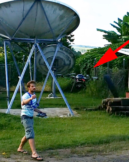
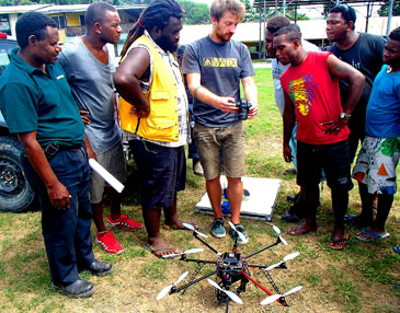
A UAV is an electrically driven, remotely piloted vertical take-off aircraft equipped with a standard camera. Using this high level technology, SPC trained over 20 officers of MEMRE and MLHS and then they took to the field over the Easter weekend to obtain valuable imagery of the Mataniko and other rivers and parts of the Guadalcanal plains. The drone use was facilitated by SPC through the voluntary services of Mr Teja Kattenborn of Germany, who was in Fiji doing work with SPC using the drone when news of the floods broke.
SPC lost no time in asking Mr Kattenborn if the drone could be used to assist the Solomon Islands government, which has relied on the technical and scientific know-how, training and assistance of SPC Geoscience for decades. Mr Kattenborn was happy to help. He is working with remote sensing expert WolfForstreuter of SPC, who has trained dozens of Solomon Island government officers in GIS and remote sensing.
As a unique multi-ministry collaboration, Mr Forstreuterand the team of ministry officials worked on the drone data, and presented their analysis to the Permanent Secretaries of three ministries and the Director of the National Disaster Office yesterday afternoon.
'Using this technology, we have produced high resolution images and digital terrain models to document the recent flooding,' said Mr Forstreuter. 'We have clearly mapped the spacial extent of the flooding and the damage. Using this information, we have worked with our counterparts to give the government high quality scientific data that can be used to ensure that people do not move back into high risk areas that we know will flood again.'
SPC's Country Office in Honiara oversees the work of the organisation in over twenty government ministries.
Photo caption above: Mr Kattenborn explains the use of the drone camera to Solomon Island government officials