SPC Geoscience Division

Latest

Snapshots 72 - DISASTER REDUCTION PROGRAMME - October 2011

E-mail Print PDF

From the Managers Desk

We have just completed the first annual meeting of the SOPAC Division of the SPC. Now no longer a separate regional intergovernmental organisation the former membership of the SOPAC Council as it was known up to 2010 was 'reconstituted' as the SOPAC Division Meeting.

The meeting included the reporting of work programme delivery by each of the threee SOPAC technical programme areas.

Importantly, the meeting endorsed a process for the development of an integrated regional strategy for Disaster Risk Management and Climate Change Adaptation & Mitigation by 2015.

Such a strategy would succeed the existing Pacific Disaster Risk Reduction and Disaster Management Framework for Action 2005 - 2015 and the Pacific Islands Framework for Action on Climate Change 2006 - 2015.

Last Updated on Tuesday, 22 November 2011 09:23 Read more...
 

2nd Annual Partners’ Meeting – Supporting Disaster Risk Reduction in Pacific OCTs Project

E-mail Print PDF

Tuesday 15 November, 2011Opening Address by Dr Russell Howorth – Director of the SOPAC Division, Secretariat of the Pacific Community (SPC)

Colleagues, may I start by first welcoming you all to the Second Annual Partners Meeting for the Supporting Disaster Risk Reduction in the Pacific Project for the Overseas Countries and Territories (OCTs) and funded by the EU from the 9th European Development Fund.

You will of course all be aware that this Project is benefitting from the outcome of the Regional Institutional Reform process (otherwise known as the RIF process) which has resulted in SOPAC the Commission becoming SOPAC the Applied Geoscience and Technology Division of the SPC from January 1st of this year.

Last Updated on Tuesday, 22 November 2011 09:24 Read more...
 

Pacific Wide Drill Tests Tsunami Preparedness

E-mail Print PDF

Wednesday November 9, 2011, Suva, Fiji - A Pacific wide exercise to test and improve the emergency response to tsunamis took place today with 20 Pacific Islands Countries, including Australia and New Zealand, running simulations and drills.

Known as Pacific Wave 11, the exercise asked countries to pick one of 10 regional or local tsunami scenarios to react to. The hypothetical tsunamis were created by powerful earthquakes off the shores of either Russia, Ryukyu Islands, west and east of the Philippines, Vanuatu, Tonga, Chile, Ecuador, Central America, and Aleutian Islands. Fiji, for example, is basing their scenario on a magnitude 8.9 earthquake in the Tonga trench, while Palau is basing theirs on a massive earthquake in the Philippine Trench.

Last Updated on Thursday, 17 November 2011 12:14 Read more...
 

Need to monitor for responsible seabed mining practices

E-mail Print PDF

Careful monitoring before, during and after the impending deep seabed mineral mining off the shores of Papua New Guinea will provide the hard data that will guide the responsible deep seabed mining practices of the future.

This is the view of Dr Charles (Chuck) Fisher, Professor of Biology, Penn State University USA, who made a presentation at the recent STAR meeting.

STAR (the Science, Technology and Resources Network) is an integral part of the SPC/SOPAC Division annual meeting that took place mid-October in Nadi, Fiji.

Last Updated on Tuesday, 15 November 2011 09:41 Read more...
 

PNG and petroleum – an indelible experience

E-mail Print PDF

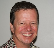
Having spent much of his working life in Papua New Guinea, petroleum geologist Michael McWalter has seen the development of the petroleum industry within PNG, and has come to call that country his home.

“I haven’t lived in England for oodles of time, so yes, PNG is very much home,” said Mr McWalter, Advisor to the PNG Department of Petroleum and Energy while attending the Annual Directors’ meeting of the Circum-Pacific Council, held this year in conjunction with the mid-October SPC/SOPAC Division’s STAR meeting in Nadi.

Last Updated on Tuesday, 15 November 2011 09:41 Read more...


Page 42 of 74

Newsflash

16 April 2013 - A survey of the South Tarawa lagoon has revealed some potentially explosive secrets from its past as one of the major battlegrounds of WWII. The survey was designed to identify battle debris that still litters the floor of the lagoon seventy years after the infamous Battle of Tarawa in 1943.

Funded by the New Zealand Regional Ocean Sciences Grant, the survey was undertaken as part of the Government’s work to reduce the atoll’s damaging reliance on beach mining by identifying potential sources of construction aggregate on the floor of the Tarawa Lagoon. The widespread practice of beach mining has been weakening the atoll’s vulnerable shoreline along with Government efforts to protect communities from the worsening impacts of climate change and rising sea levels.

The Government turned to SOPAC, the region’s Applied Geoscience & Technology Division of the Secretariat of the Pacific Community, for guidance on safe methods to dredge an alternative source of sand and gravel from Tarawa’s southern lagoon. Before dredging can begin, as part of the European-Union funded Environmentally Safe Aggregate for Tarawa (ESAT) project, SOPAC first needed to identify any potential problems that might be posed by any unidentified and unexploded ordnance.

During WWII, the islands of Kiribati saw some of the Pacific’s bloodiest encounters.  From 20-24 November 1943, an invasion flotilla of 18,000 US Naval and Marine Corps troops attacked the fortified Japanese garrison on Betio in Southern Tarawa. The 4,600 Japanese defenders fought almost to the last man, and more than 1,000 Americans lost their lives.

SOPAC’s Survey Leader, Geophysicist Robert Smith, is still analysing the data but he has already identified two previously unknown vessel wrecks and unearthed numerous artillery remnants. Of the vessels, Smith says, “These may be sunken Higgins boats, which would have carried 20-30 marines each.” The US government has already expressed a keen interest in Smith’s findings.