


 The Secretariat of the Pacific Community (SPC) has embarked on a programme to build capacity in mapping land/forest cover in Fiji using very high resolution satellite images. The programme has three phases consisting of both theory and practical work, including ‘ground truthing’ (on-site verification of data from satellite imagery) exercises to be held later this month.
The training, which is jointly organised by SPC’s Land Resources Division (LRD) and its Applied Geoscience and Technology (SOPAC) Division, involves participants from the Fiji Department of Forestry and SPC.
The ground truthing exercise will be undertaken in Drawa – a model area for sustainable natural resource management located in Vanua Levu that covers about 6,400 hectares of indigenous forest.
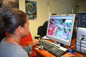
The first phase of the training exercise focuses on enhancing and analysing satellite images of Drawa forest to classify it into different forest types and using the information to conduct forest inventory for the estimation of forest carbon stock per unit area of each forest type.
The second phase of the training will include establishing monitoring plots with wood and carbon stock assessment, while the third phase will focus on carrying out a biodiversity survey.
SPC Regional Community Forester Jalesi Mateboto explained that two projects currently support the work in Drawa: Live & Learn, a non-governmental organisation (NGO) that is conducting community-based activities related to REDD+ (Reducing Emissions from Deforestation and Forest Degradation) in the area with financial support from the European Union; and the Land Owners Association of Drawa, which is implementing the Drawa Forest Biodiversity Conservation Project with a grant from the Global Environment Fund (GEF) and the United Nations Development Program (UNDP).
SPC’s LRD is joining the work in response to requests from these projects for technical support.
Mr Mateboto also said that the objectives of SPC’s involvement in Drawa are to build the capacity of community groups, NGOs and the relevant government agencies in the area of forest monitoring and forest carbon assessment; to provide accurate forest carbon data to assist the community-based activities related to REDD+ in Drawa; and to test and improve the monitoring, assessment and reporting manual for sustainable forest management in Pacific Island countries. It is hoped that these activities will also contribute to the establishment of Fiji’s national Measurement, Reporting and Verification system, strengthening the country’s REDD+ programme.
The Japan International Cooperation Agency (JICA) and the German development cooperation agency Deutsche Gesellschaft für Internationale Zusammenarbeit (GIZ) are supporting this exercise, which also responds to some of the forestry priorities specified in the SPC/Fiji Joint Country Strategy.
[Ends]
(For further information please contact Vinesh Prasad on telephone (679) 3370733 or email LRD Help Desk -
This e-mail address is being protected from spambots. You need JavaScript enabled to view it
)

