


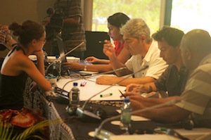
 In a Pacific first, a delegation of 14 representatives from four Pacific Overseas Countries/Territories (OCTs) met in Nadi, Fiji for a meeting to exchange information and ideas on issues around water, sanitation and disaster risk management.
The exchange between French Polynesia, New Caledonia, Wallis & Futuna, Pitcairn Island and Fiji reflects the growing interaction and increased closeness between Pacific OCTs and other Pacific Island Countries (PICS).
The OCT delegates toured Nadi to learn more about local activities to improve water, sanitation and disaster preparedness. They visited downtown Nadi to see the effects of the 2009 floods and also visited sites that are part of a Global Environment Facility (GEF) demonstration project, which aims to use Integrated Water Resources Management (IWRM) to reduce the impact of flooding in the area.
Vinesh Kumar, Nadi GEF Demonstration Project manager, said he believed the exchange would benefit all parties.
“We hope that by highlighting the holistic approaches we are using to lessen the impacts of flooding, our OCT friends will take home some new ideas on how to deal with their local issues,” Mr Kumar said. “We also see this as the start of a close relationship where we can also learn from some of the activities in the OCTs.”
The exchange is part of a European Union (EU) funded project run through the Secretariat of the Pacific Community’s (SPC) Applied Geoscience and Technology Division’s (SOPAC) Disaster Reduction Programme.
Frederique Lehoux, Team Leader for Disaster Risk Reduction in Pacific OCTs at SOPAC said that while this exchange was a first, she hoped that there would be many more to follow.
“All of us in the Pacific face very similar risks and challenges that are not defined by national boundaries,” Ms Lehoux said. “By sharing our experiences, fostering new relationships and working together we have a much better chance of success.
SOPAC is helping the Pacific OCTs reduce natural disaster and water-borne public health risks by generating scientific & technical data for better planning and development, providing solutions to mitigate disasters before they happen, and through cross-learning within OCTs, and between OCTs and PICs.
French Polynesia is working to reduce two types of risks faced by the country: tsunamis in the Marquesas archipelago and cyclonic waves in the Tuamotus. Both initiatives will seek to reinforce the safety of populations. In the Marquesas this will be done by repairing sirens and developing local capacity to maintain them, and in the Tuamotus by identifying precise zones at risk and refining building codes.
Wallis and Futuna, also highly exposed to tsunamis, is looking to enhance the safety of its people and infrastructure in the face of natural disasters.
New Caledonia is looking to reduce public health risks resulting from contaminated drinking water, inadequate sanitation and drought. The country-wide project seeks to enhance the safety of drinking water and bridge the sanitation gap which puts the population and surrounding lagoons at risk.
Pitcairn Islanders are experiencing longer, more severe periods of drought whose effects can be devastating on many fronts, including crop production, and drinking water consumption. Pitcairn will be closely monitoring its climate, weather and water resources and use this information to bolster the island’s water catchment, storage, treatment and distribution capacity. Pitcairn is also enhancing its water and meteorology governance arrangements.
CONTACT
Tiy Chung, SOPAC Communications Advisor, on: (mobile) 998 7586, or (email)
This e-mail address is being protected from spambots. You need JavaScript enabled to view it

