 Pacific Island nations can now access information that could change their response to the threat of natural hazards, and indicate options for managing the financial burden of disasters.
The Pacific Catastrophe Risk Assessment and Financing Initiative, a two-year project, has resulted in “the most comprehensive set of data ever collected within the Pacific Islands.”
“I would like to see the available data to be implemented in Pacific Island Governments for everyday processes, whether it be for asset management, building standards and controls, planning, or monitoring the impact of disasters,” said consulting scientist Phil Glassey, Head of Regional Geology Department, GNS Science New Zealand.
Speaking to more than 200 delegates at the SPC/SOPAC Division 3rd Session of the Pacific Platform for Disaster Risk Management, Mr Glassey said that information had been gathered from eleven Pacific Island countries through a joint initiative: SPC/SOPAC Division, the World Bank and the Asian Development Bank, with technical support from AIR Worldwide, GNS Science, the Pacific Disaster Center, and assistance from trained technical staff from within the Pacific Island countries.
Disasters in the region since 1950 have affected more than nine million people, caused just under 10,000 deaths, and have cost Pacific Island countries an estimated US$3.2 million in associated damage. Having access to this data can assist in disaster preparedness and damage reduction.
Mr Glassey explained that the information gathered during the Pacific Risk Assessment Initiative by contributing partner AIR Worldwide included a historical analysis of 450 disasters, from 1831 to 2009, and the frequency of these events, which made it possible to produce detailed hazard models for each of the countries.
The hazard models constructed by AIR Worldwide show the impact of tropical cyclones, earthquakes, tsunamis, storm surges, landslides, floods, and severe local storms.
This includes the potential loss of life, damage to buildings, crops and infrastructure, as well as the cost in dollar value to rebuild and recuperate from an event.
Governments can access information as to which disasters they should prepare for. For example, Papua New Guinea has a history of many earthquakes, but only a few cyclones. Therefore, the country would concentrate on earthquake preparedness, rather than for cyclones.
The database contains information about the distribution of populations; major cash crops (such as coconut, banana or dalo); the location and structure of water, waste water and electrical utilities, infrastructure such as bridges, dams, and ports, and of an “astounding” 3.5 million commercial and public buildings.
Mr Glassey explained that there was detailed information describing 80,000 of these buildings, while the characteristics of the remainder have “been assumed, using statistical methods.”
He said the data collected could be utilised by Ministries and Offices for Disaster Risk Management, and Ministries of Finance and Planning, making informed decisions possible.
It gives planners the opportunity to strengthen existing buildings and infrastructure, or to increase new building code requirements before, for example, a cyclone or a tsunami strikes.
The immediate cost of such changes can be calculated against the cost of replacement or repair if strengthening measures are not implemented, so it is possible to assess the risk to future development if finances are diverted to meet the cost, immediate and in the aftermath, of a disaster.
Mr Glassey said that a possible future outcome from the Initiative could be the pooling of resources on a regional level as a part of disaster preparedness.
Commenting on the establishment of the database, which will be housed at the SOPAC Division of the SPC, the Director of the SOPAC Division, Dr Russell Howorth said,
”This is a very real and tangible development that will benefit Pacific Island countries as they engage in better planning and preparedness initiatives.
“Work now planned will involve ensuring that the ownership and capacity to fully utilise the very large information database is driven nationally, from capitals around the region,” concluded Dr Howorth.
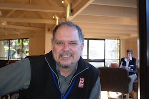
Photo caption: Mr Philip Glassey, during the recent SPC/SOPAC Division 3rd Pacific Platform for Disaster Risk Management in Auckland.
Home  News & Media Releases Latest Managing Risk Now A Priority In The Pacific
Managing Risk Now A Priority In The Pacific


Newsflash
Six Pacific island countries are in the process of reviewing the progress made in relation to their disaster risk management action plans and strategies. |

