Fiji and Tuvalu sign maritime boundary agreement
Friday, 24 October 2014 08:40
administrator
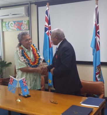
Wednesday 22 October 2014 – Secretariat of the Pacific Community (SPC) – Suva, Fiji: Last Friday was an important occasion for the governments of Fiji and Tuvalu as a maritime boundary agreement was signed by the Prime Minister of Fiji, Honourable Voreqe Bainimarama, and the Prime Minister of Tuvalu, Honourable Enele Sopoaga. This signing event concluded many years of negotiations between senior government officials of both countries.
The Secretariat of the Pacific Community (SPC), through its Applied Geoscience and Technology Division (AGTD), assists member countries in the technical preparations of negotiations between neighbouring countries to legalise the extent of national areas of jurisdiction under the United Nations Convention on the Law of the Sea (UNCLOS). The Regional Maritime Boundaries Unit within AGTD coordinates this support to member countries, working closely with its partners, which include the Pacific Islands Forum Fisheries Agency, Geoscience Australia, the Commonwealth Secretariat, the United Nations Environment Programme GRID-Arendal Centre, the Australian Attorney General’s Office and the University of Sydney.
The Pacific Islands region has approximately 48 shared maritime boundaries, where neighbouring exclusive economic zones overlap. Counting the treaty signed between Fiji and Tuvalu last week, 33 of these boundaries are subject to a formal treaty.
During the signing ceremony, PM Bainimarama stated, 'As Pacific small island developing states, we have proven to the international community that we are no strangers to concluding highly technical and complex negotiations under the UN Convention on the Law of the Sea.'
Last Updated on Thursday, 06 November 2014 07:53
Read more...
|
Vanuatu Government seeks views of the people on deep sea mining
Thursday, 16 October 2014 08:23
administrator
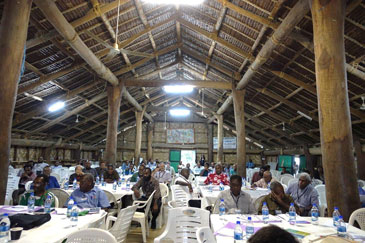
Tuesday 14 October 2014, Secretariat of the Pacific Community (SPC), Suva, Fiji: Last week in Port Vila, the Republic of Vanuatu commenced on a national consultation on a draft Deep Sea Minerals Policy. This is the first in a series of consultations to be held in every province.
Past studies in Vanuatu’s waters revealed the presence of seafloor massive sulphide deposits within its exclusive economic zone, which could contain significant quantities of copper, gold, zinc, silver and other commercially viable minerals. The presence of such minerals could present a potential economic opportunity for Vanuatu if deep sea mining activity is properly conducted and balanced with appropriate environmental, legal and financial management.
The draft Policy sets out Vanuatu’s vision and strategic goals in relation to its deep sea minerals, and will form the basis for future drafting of laws in line with the policy. The draft Policy has been prepared by the Ministry of Lands with advice from the Deep Sea Minerals (DSM) Project: a partnership between the Secretariat of the Pacific Community (SPC) and the European Union (EU).
The DSM Project works to assist 15 Pacific Island countries to improve governance and management of their deep-sea mineral resources, including through the development of national policies and laws.
Last Updated on Thursday, 19 March 2015 13:08
Read more...
UN Women and SPC sign memorandum of understanding
Thursday, 16 October 2014 08:17
administrator
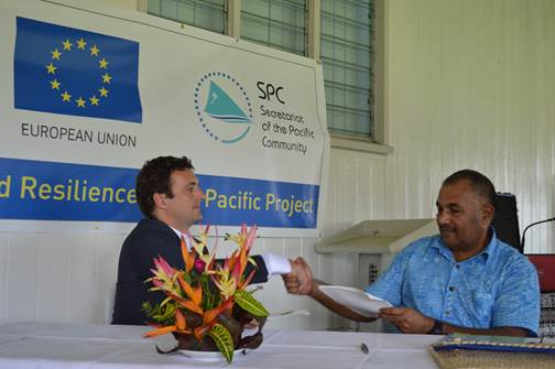
Wednesday 15 October 2014, Secretariat of the Pacific Community (SPC) – Suva, Fiji: UN Women and the Secretariat of the Pacific Community (SPC) commemorated International Day of Rural Women with an event that showcased stories from rural women themselves and culminated in the signing of a Memorandum of Understanding (MoU).
Through the MoU, UN Women and the African, Caribbean and Pacific Group of States (ACP) – European Union (ACP-EU)-funded SPC implemented “Building Safety and Resilience in the Pacific Project” (BSRP) will work in collaboration to ensure the different needs, capacities, constraints and social roles of women and men are included in the design and implementation of the BSRP project activities. It is also aimed at strengthening the capacity of the 15 countries that the BSRP works in.
UN Women’s Deputy Representative for the Fiji Multi-Country Office, Nicolas Burniat, signed the MoU on behalf of UN Women and highlighted the importance of including women and girls to ensure the sustainability of climate change and disaster risk reduction strategies. The ACP-EU SPC BSRP project aims to reduce the vulnerability, as well as the social, economic and environmental costs, of disasters caused by natural hazards in the Pacific.
Inoke Ratukalou, Director of Lands Resources Division and Officer in Charge at SPC, says the MoU will play a big part in ensuring gender mainstreaming across the project’s activities.
Last Updated on Tuesday, 11 November 2014 09:19
Read more...
|
Samoa develops capability for conducting Post Disaster Needs Assessments
Thursday, 16 October 2014 08:13
administrator
Tuesday 14 October 2014, Secretariat of the Pacific Community (SPC) – Suva, Fiji: sWhat is the true cost of a disaster in human and economic terms and, once we know, what can we do to reduce the burden the next time?
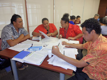
These are the questions that were considered last week by a group of 29 participants as they completed Samoa’s first national training course in “Post Disaster Needs Assessment” (PDNA). The training, supported by the African, Caribbean and Pacific Group of States (ACP) – European Union (ACP-EU)-funded “Building Safety and Resilience in the Pacific Project” (BSRP) is implemented by the Secretariat of the Pacific Community (SPC) and forms part of Samoa’s preparations for the forthcoming Tropical Cyclone season.
Samoa presently leads the way in conducting PDNAs in the region, having already conducted two assessments: the first in 2009, following the earthquake and tsunami and, the second in 2012, following Tropical Cyclone Evan. Both Assessments revealed the true economic cost of the disasters, far exceeding original estimates. The level of detail and accuracy contained within the assessments provided a strong foundation for the identification and prioritisation of appropriate measures to effect timely recovery and reconstruction.
Last Updated on Thursday, 16 October 2014 08:20
Read more...
National Seabed Minerals Management Board launched in Marshall Islands
Tuesday, 14 October 2014 08:50
administrator

Monday 13 October 2014, Secretariat of the Pacific Community (SPC), Suva, Fiji - The Government of the Republic of the Marshall Islands (RMI) formed an Interim National Seabed Minerals Management Board (INSMB) on 2 October 2014. The board members, consisting of a small team of government officers and non-governmental representatives, are tasked by Cabinet to develop national policy and law for the appropriate governance of the nation’s deep sea resources. The Board will receive financial support and technical assistance from the Deep Sea Minerals (DSM) Project: a partnership between the Secretariat of the Pacific Community (SPC) and the European Union (EU).
Old tales of treasure at the bottom of the ocean did not sound so fanciful in Majuro two weeks ago, when INSMB held its inaugural meeting to discuss the precious metals known to exist in the nation’s deep seabed.
INSMB Chairperson Rebecca Lorennij (Secretary for the Ministry of Resources and Development) thanked those at the meeting: ‘The RMI government and its people would like to thank SPC and the EU through the SPC–EU DSM Project for the ongoing support provided during the past few years.
The INSMB will now progress further with the national policy on deep seabed mining and the Seabed Management Bill before approval by the RMI government, a prerequisite to establish responsible governance and management of these resources.’
Last Updated on Thursday, 19 March 2015 13:09
Read more...
|
|
|
|
|
|
Page 8 of 74 |


