


Data Release Report by Joanne Robbins
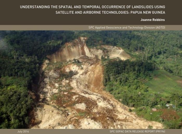
Landslides pose a significant threat to life and infrastructure in Papua New Guinea (PNG), with numerous movements being recorded annually. Such events are typically instigated by the combined effects of different geomorphological control factors, such as slope or geology, and the influence of a triggering event (i.e. an earthquake or heavy rainfall). Rugged topography and high seismicity combine in PNG, to make the region highly susceptible to large-volume, earthquake-induced landslides, while the climate encourages widespread rainfall-induced landslides. Of the two triggering mechanisms, understanding rainfall-induced landslide occurrence offers the best scope for early warning/forecasting system development, as meteorological models and data availability improve.
This paper presents an overview of research conducted to understand regionally-based, rainfall-induced landslide occurrence in PNG. Given the regional focus of this research and the need to develop a cost effective and reproducible methodology, pre-existing or freely available satellite and airborne data have been used. The aim of this research was to develop models capable of identifying rainfall events with the potential to trigger landslides, as well as models that distinguish areas of heightened landslide susceptibility from those with low/no landslide susceptibility. Together, these modelling approaches can be used to generate a broad-scale early warning/forecasting system, which could help to reduce the losses associated with landslides across PNG.

