


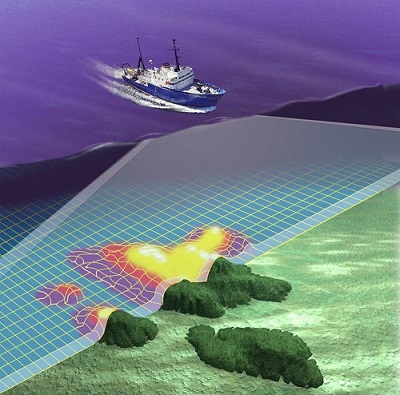
9 April 2014, Secretariat of the Pacific Community (SPC), Suva, Fiji – Work begins next week on a series of underwater surveys to produce updated navigational charts for Vanuatu. Like many Pacific Island countries, Vanuatu has a vast maritime area. Modern charts will result in safer navigation for both cargo shipping and cruise ships, producing economic and social benefits for Vanuatu.
A team of hydrographers and technicians from the Government of Vanuatu and the Secretariat of the Pacific Community’s Geoscience Division (GSD) will collect the necessary data over several months. Their supported by the New Zealand government, the United Kingdom’s Hydrographic Office, and the Government of Vanuatu.
The survey will chart four critical areas which have been identified through a risk assessment carried out by New Zealand – Luganville and Champagne Bay on Espiritu Santo, and the islands of Wala, Malekula, and Homo Bay, Pentecost.
‘The port of Luganville in particular is of high economic value to Vanuatu,’ says Mr Jens Kruger, Acting Deputy Director of SPC’s Geoscience for Development Programme. ‘The current chart from this port relies mostly on 19th century data and no new information has been added to the chart since the Second World War.’
Starting in July 2014, the International Maritime Organisation’s Safety of Life at Sea Convention regulations will require member countries to move toward using electronic navigational charts in their regions for safe shipping reasons.
Failure to update nautical charts such as those in Luganville will result in these charts eventually being removed from circulation. This in turn, would cause cruise ships to withdraw from their current routes, severely impacting local tourism.
‘Hydrographic services have been shown to have a cost-benefit ratio of more than 1:10, as they drive growth in other sectors like shipping and tourism,’ says Kruger.
Vanuatu’s Government is showing good foresight in addressing this issue now. The new charts will serve as an important component of Vanuatu’s maritime infrastructure for the next 30 years.
For more information, contact Molly Powers-Tora (tel: +679 338 1377 ; email: This e-mail address is being protected from spambots. You need JavaScript enabled to view it ) or visit the SPC website: www.spc.int.

