


This year Kiribati, one of the least developed countries in the world, finalised maritime boundaries with the United States of America.
The successful outcome, in September, was the result of the work that the Pacific Island country, along with 12 others, undertook at the Maritime Boundaries and Ocean Governance working sessions at the University of Sydney.
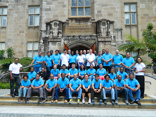
The latest session is currently underway at the University and ends on 6 December.
"Technical and legal personnel from thesePacific Islandcountries have been coming to the University of Sydney for the last six years to secure rights to their marine spaces," said Professor Elaine Baker from the University's School of Geosciences, which hosts the meetings.
"Global interest in marine resources, including fisheries and seabed minerals, and the threat of climate change and sea level rise, has spurred Pacific Island countries to settle their maritime boundaries."
The Cook Islands, for example, has valuable deposits of seabed minerals, many of which are essential to new technologies such as renewable energy and communications equipment. In order for the Cook Islands to capitalise on these resources, they require sound governance frameworks and jurisdictional boundaries.
"Settling maritime boundaries in other areas of the world is often highly contentious but a striking feature of this region is the cooperative approach," said Professor Baker. "This has resulted in unprecedented progress in settling the boundaries between countries and, at this time, the Pacific leads the world."
The Kiribati agreement settles the exclusive economic zone boundary between Kiribati's Phoenix and northern Line Islands and, on the US side, Howard and Baker Islands, Kingman Reef and Palmyra Atoll, and Jarvis Island.
At the working sessions countries negotiated shared maritime boundaries and drafted modern maritime zones legislation. All Pacific Island countries are party to the United Nations Convention on the Law of the Sea, entitling them to an exclusive economic zone extending 200 nautical miles from their coastlines.
Some countries are also entitled to claim areas beyond the 200 mile zone. They have made submissions to the United Nations that would see them increase their cumulative seabed territory by an area equivalent to the size of India.
The School of Geosciences provides administrative, technical and scientific oversight to the working sessions and its staff developed the online data portal that provides access to Pacific marine spatial information. The School's work is through its association with GRID-Arendal, an official centre collaborating with the United Nations Environment Programme.
Dr Arthur Webb, from the Secretariat of the South Pacific Community, said, "We have achieved more progress in the last six years with this program than in the last three decades. Not only have Pacific Island countries worked collaboratively to settle maritime boundaries, they have also submitted joint claims to seabed territory which may contain valuable mineral resources."
The next step for the program will be to deliver a framework of best-practice marine governance.
The program is a collaboration between the University of Sydney, GRID-Arendal, Geoscience Australia, the Commonwealth Secretariat, the Secretariat of the Pacific Community, the Forum Fisheries Agency, and the Australian Attorney General's Department.

