


 The safety of navigation and the protection of the marine environment in the region took a positive step forward recently with the signing of a Memorandum of Understanding between the International Hydrographic Organization (IHO) and Secretariat of the Pacific Community (SPC). Hydrography is the study, surveying, and mapping of the oceans, seas and rivers, especially related to navigation and the environment.
IHO is comprised of 80 member governments represented by their respective national hydrographic offices. Its objectives include the standardization of nautical charts as well as the adoption of reliable and efficient methods to conduct hydrographic surveys.
The purpose of the MOU is to provide a framework for cooperation between the IHO and SPC to support the efficient and effective development and coordination of hydrographic and nautical charting programmes for Pacific island countries and territories.
This is in accordance with the requirements of international treaty obligations.
Dr. Russell Howorth, Director of SOPAC, a Division of SPC, said that the agreement would be of substantial value to the region.
“SOPAC has been developing bathymetry charts, by measuring the depth of oceans and seas, for many years, but IHO is the only organization that can officially stamp charts as suitable for navigation,” said Dr. Howorth.
Additionally the MOU is to promote the widespread use of hydrographic data collected by the two organisations or their members for the benefit of safety of navigation and life at sea, protection of the marine environment, national infrastructure development, coastal zone management, marine exploration and resource exploitation, maritime boundary delimitation and policing, maritime defense and security, and natural disaster management.
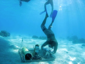
Above: Jens Kruger setting oceanographic instruments in Aitutaki Lagoon in the Cook.
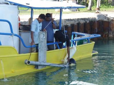
Bottom: (Left to right) SPC/SOPAC’S Peni Musanamasi and Donato Rquica place echo sounder equipment into Aitutaki Lagoon as part of a hydrographic survey

