


 “Satellite technology has made an enormous improvement to our operations,” said Mr Robinson Wood, GIS Supervisor, Solomon Islands Electricity Authority (SIEA).
In Suva recently to participate in the week long Geographical Information Systems (GIS)/Remote Sensing User Conference held at the Holiday Inn, Mr Wood said that his involvement with GIS began in 1998, when European Union funding made it possible for the Authority to acquire its first equipment and software as the basis of developing the use of GIS in the organization.
Mr Wood explained that GIS is a computer-based tool, making it possible to collect, combine and overlay information in the form of easily understood maps. These maps are constructed from up-to-date-satellite images that are pinpoint accurate in both image and information. He said that these images are so exact that individual power poles can be detected in a specific area.
“Training was facilitated by Dr Wolf Forstreuter of SOPAC, and I was selected for this training based on my experience and knowledge as a linesman for the Solomon Islands Electricity Authority,” said Mr Wood.
SOPAC provides assistance to 19 island countries and territories in the Pacific region through system installation and enhancement and “continues to make a major contribution by providing training and ongoing support in the field of GIS,” said Mr Wood.
While training, Mr Wood began the data collection of the Electricity Authority’s assets such as buildings, transformers, lines and poles, as well as customer details.
“The Authority is able to use these satellite images as a risk management tool in project planning,” said Mr Wood. “We can measure exact distances, analyse the terrain, and see if there is existing road access, all during the preliminary design stages of future development planning.”
Mr Wood said that with the advent of GIS, the problem of meter tampering was being addressed. “Our consumers have become aware that with GIS equipment we are able to monitor meter boxes and tell if they have been tampered with.
“At the outset, SIEA also identified some 4000 consumers who had not received or paid an electricity bill for three years.
“When we studied the GIS grid, we could pinpoint electricity usage. We became aware of discrepancies between the number of households consuming electricity, consumption rates and billing units. Consequently, we conducted a customer audit, and found internal corruption in the billing system. The perpetrator’s employment came to an abrupt end.”
END
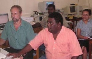
Photo caption: SOPAC’s Dr Wolf Forstreuter and Mr Robinson Wood of SIEA working on the database while watched by SIEA staff.

