
 “What is an absolute necessity is these Geographic Information System (GIS) and Remote Sensing (RS) tools are developed in an integrated and strategic manner for all those involved in these technologies.”
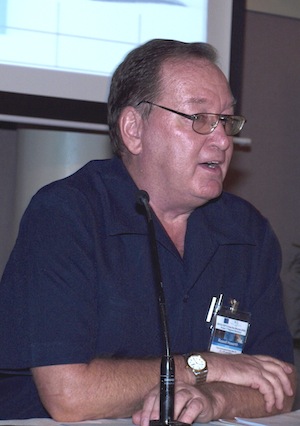
Dr. Howorth, the Director of the SOPAC Division of the SPC, was addressing the first Solomon Islands National Geographic Information System (GIS) and Remote Sensing Stakeholder Meeting as its keynote speaker.
He said that the goal of the SOPAC Division is to apply geoscience and technology to realize new opportunities for improving the livelihoods of Pacific communities. GIS and Remote Sensing is clearly a technology that can contribute to realizing improving livelihoods.
GIS is a computer-based tool used to collect, combine and overlay information in the form of easily understood maps constructed from up-to-date satellite images and field data, while Remote Sensing is the collection of information about the earth from a number of sources that could utilize satellites, aircraft, or electromagnetic radiation.
Dr. Howorth told the participants that Pacific islands share much in common and the Solomon Islands is no exception.
“Each has its own needs, particular challenges and opportunities, many of which stem from the largest shared resource, the Pacific Ocean.
“The ocean feeds us (and a large part of the global community), it endangers us (cyclones, storm surges, and tsunamis), and underpins the many challenges we face (isolation from markets, high cost of imports and exports, cost of internal transport), and provides opportunities for economic development (for example and including tourism, fisheries, seabed minerals).
“So in the context of the “needs of the Solomon Islands” what does GIS and Remote Sensing bring to offer in order to contribute to building resilience and managing the risks to the country’s vulnerabilities?
“As an example, A Risk Exposure Profile has been produced for the country. The profile documents the exposure to risks of many of its buildings and infrastructure and the replacement cost from damage,” said Dr. Howorth.
This was achieved through the capture of images of nearly 169,000 buildings, digitized from high-resolution satellite imagery. Of these, more than 12,000 buildings, including more than 7,000 near the national capital of Honiara, were also surveyed, but from the ground, and photographed by a team of inspectors deployed for this purpose – both the satellite and ground images are stored in the Risk Exposure Profile GIS database.
The Pacific Catastrophe Risk and Financing Initiative of SPC/SOPAC, World Bank and the Asian Development Bank produced the profile.
The next step is to build national capacity to use the Risk Profile and its GIS database. This work will continue to be coordinated by the Solomon Islands National Disaster Management Office,” he said.
Although the country profile also includes an initial land use map showing the location of major crops, currently there are no maps in the Solomon Islands showing the land cover of agriculture, and forest (including mangroves and forest plantations, pasture land and settlement areas.).
In a new project, a GIS database will be built from new satellite images at a scale of 1:50,000 (or 1 centimetre on the image represents 500 metres on the ground). The project is funded by the US Agency for International Development.
These new satellite images will, for the first time, provide maps containing new and detailed data that will assist improved planning for future development.
CAPTION: Russell Howorth, Director SPC/SOPAC Division
For further information contact
This e-mail address is being protected from spambots. You need JavaScript enabled to view it