
 “Satellite technology has changed the way that Utility companies throughout the South Pacific manage assets and plan future development.”
So said Dr Wolf Forstreuter, SOPAC’s Remote Sensing and GIS Specialist. Dr Forstreuter has been responsible for the on-going delivery of the EU-funded programme to assist South Pacific Utility companies with GIS.
The programme was first introduced in Tonga, closely followed by the Solomon Islands, Fiji and a similar programme later for Samoa and Tuvalu.
GIS (Geographical Information Systems) is a computer-based tool, to collect, combine and overlay information in the form of easily understood maps constructed from up-to-date-satellite images and field data.
“Most Utility companies such as Electricity, Water, Telecommunications, or Public Works Road Maintenance Divisions within the Pacific Island Forum countries now use GIS as a management tool,” said Dr Forstreuter.
Dr Forstreuter said that although utility companies and organisations have similar asset management needs, each requires a specific GIS system linked to the differing billing systems, making it possible to track customer consumption.
“GIS provides the spatial component to pinpoint accurate information and images,” explained Dr Forstreuter. “The advent of high-resolution satellite imagery in 2000 made GIS possible.”
Mr Timoci Bavadra, GIS Coordinator, Fiji Electricity Authority endorsed the contribution made by Dr Forstreuter and SOPAC to the development of expertise in GIS throughout the Pacific over the past 13 years.
“Before Dr Forstreuter introduced the use of GIS, FEA’s transmission and distribution information were recorded and kept in hard copies. We used these hard copy drawings which had limited information for planning, asset management and operation,” said Mr Bavadra.
Mr Bavadra explained that with GIS more distribution information has been made available. “Features and attributes of poles and equipment such as the type of poles, whether concrete or wooden, their length, the type of pole dressings, whether voltage is high or low; the location, number and rating of transformers; the number of customers connected; the location of line protection equipment; the number, size and type of fuses, can all be shown in one computer screen.
“Some 74,000 poles together with their individual information had been captured for the Viti Levu distribution, and with digital land maps, up-to-date satellite images as backdrops, our people can easily zoom in to areas and open up available information in the GIS.”
All of this data had to be captured by technicians using Global Positioning devices to gather accurate information after logging into five or six satellites.
Mr Bavadra said that as well as being invaluable as a planning and asset management tool, GIS saves FEA time, money, fuel, and from dependence upon the weather when maintenance is required or a fault must be located.
Mr Robinson Wood, GIS Supervisor, Solomon Islands Electricity Authority (SIEA), affirmed Mr Bavadra’s comments, adding that with the advent of GIS, the problem of meter tampering in the Solomon Islands was being addressed.
“Our consumers have become aware that with GIS equipment we are able to monitor meter boxes and tell if they have been tampered with.
“At the outset, SIEA also identified some 4000 consumers who had not received or paid an electricity bill for three years.
“When we studied the GIS grid, we could pinpoint electricity usage. We became aware of discrepancies between the number of households consuming electricity, consumption rates and billing units. Consequently, we conducted a customer audit, and found internal corruption in the billing system. The perpetrator’s employment came to an abrupt end,” said Mr Wood.
“Utility companies throughout the Pacific have committed to the ongoing capacity building of their own staff, like Mr Bavadra and Mr Wood, who have the expertise to programme, update and maintain GIS within their organisations,” concluded Dr Forstreuter.
END.
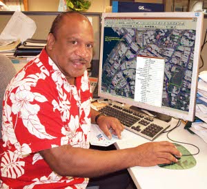
Photo caption:
FEA’s Mr Timoci Bavadra demonstrates on screen all the information available with GIS about one power pole in Suva city.